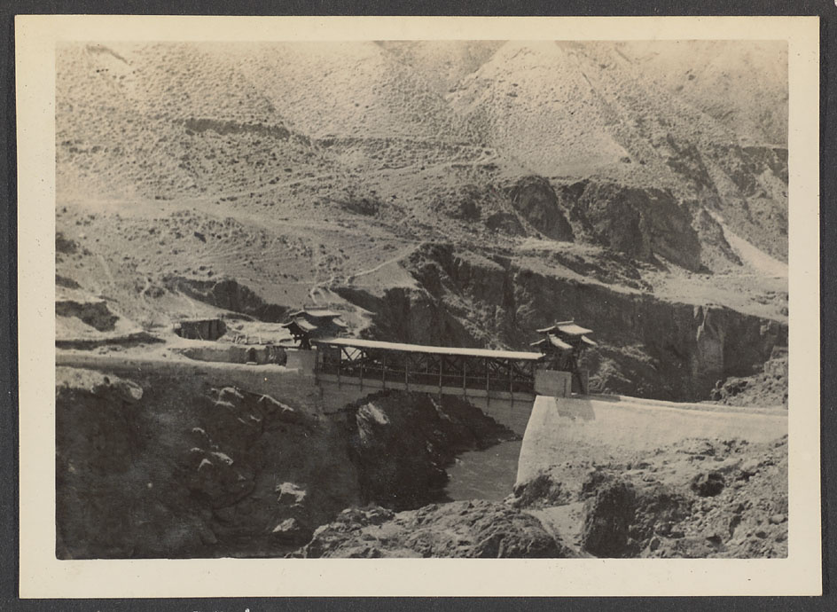
Tsinghai or Koko Nor. Tatung River. Left is Tsinghai, right is Kansu.

Collection
Identifier
Hv44-024
Copyright
© President and Fellows of Harvard College
Notes
Historical Photographs of China album reference: Hv44. Dr. Samuel M. Zwemer's visit to China, part 1. First part of an album containing photographs taken by Christian missionaries Claude L. Pickens, Jr. and Carter Holton. General note: Excerpt from unpublished photo essay, plate 4: "The bridge across the Tatung River which divides the provinces of Tsinghai and Kansu north of the Sining River near which this picture was taken. To the right is Kansu, to the left is Tsinghai, Moslem governed territory, which includes the Norther[n] part of Tibet. Such cantilever bridges are common in Tsinghai, Ma Pu-fang having constructed a number of new ones only recently." Access to original photographs and albums in the Rev. Claude L. Pickens, Jr. Collection is restricted. Photographs and images from the collection may be reproduced only with written permission. Contact the Harvard-Yenching Library for permissions and fees.
Location
Estimated Date
1933
Photographer
Material
Paper
Media
Black and white photograph
Repository
Harvard-Yenching Library, USA


